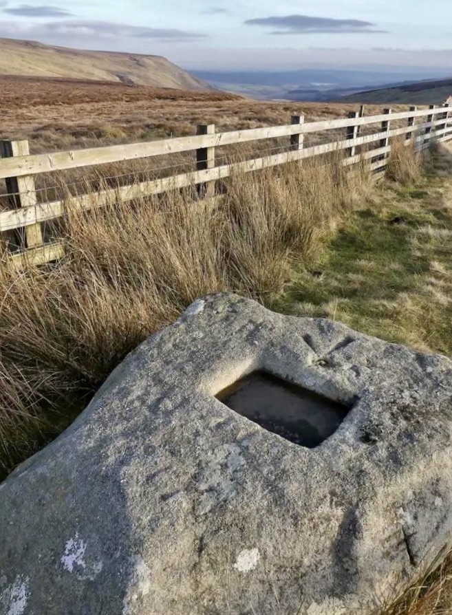
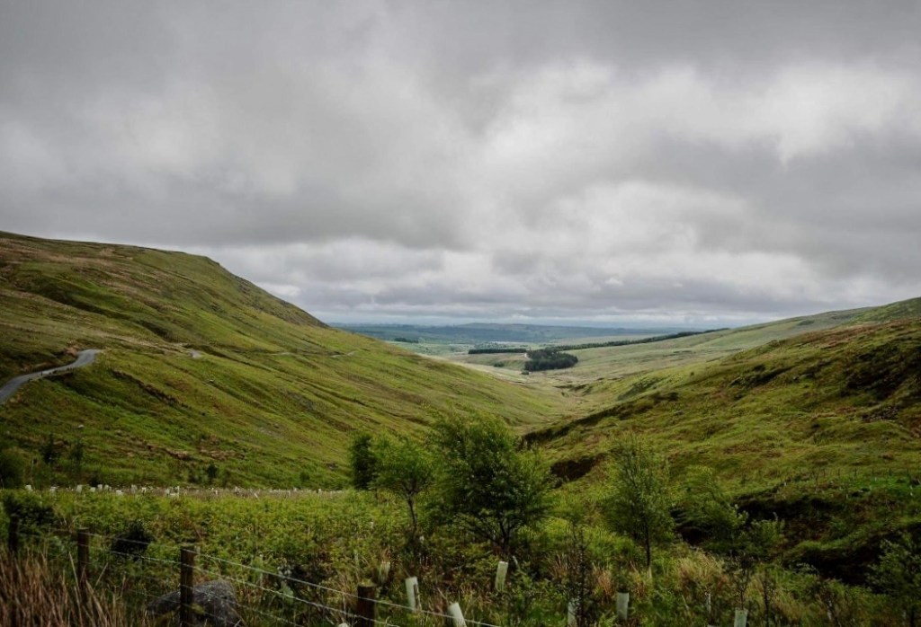
The Cross of Greet, or Top o’ Cross, is located on the highest point of the fell road between the villages of Slaidburn and Bentham at 1400 ft above sea level, marking both the watersheds of the Ribble and Lune rivers and the old, pre 1974, Lancashire/Yorkshire boundary.
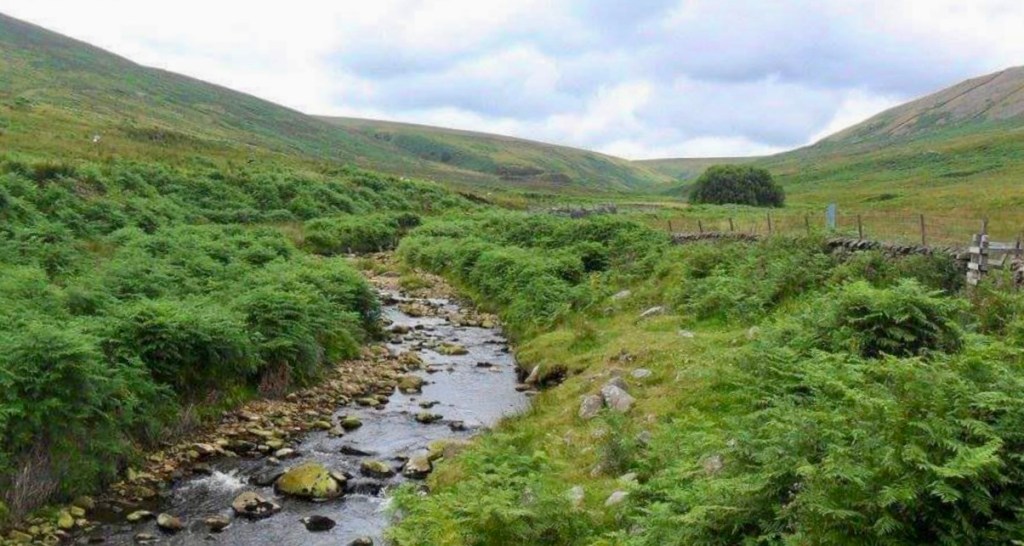
It sits at the top of the Hodder valley between Catlow Fell and White Hill, where the Hodder has its source, and about a mile away from an outcrop of rock called ‘White Greet’, which is one of several possible sources for its name. The road which it sits beside is sometimes known locally as the ‘Cross of Greet road’, ‘Cross road’ or ‘Lythe fell road’ and crosses the Hodder downstream of the cross over a bridge called the ‘Cross of Greet bridge’, although this isn’t its official name.
History
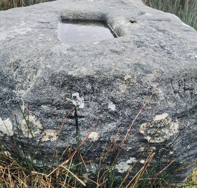
The history of the Cross of Greet is as foggy as its name and the weather conditions you might experience up there, many different reasons for its existence have been postulated over the years. One theory that is commonly accepted, and backed up by the history of very similar stones elsewhere in the world, is that it is the base for a wooden cross which has long since been lost.
The cross would have sat in the square hole which still remains carved into the gritstone and would have marked the way between resting chapels for local parishioners on their way to church or for pilgrims on longer journeys across the country.
The prominent location on the apex of the hill would have made it a very obvious beacon for travellers lost on the pass in bad weather or blizzards, which are a real risk on this road for a lot of the year and would have been more so before it was tarmac’d and signposted properly, in fact the peatbogs between the cross and the flanks of nearby White Hill are still treacherous to this day.
On older maps the location is marked as ‘Grete’ rather than ‘Greet’ and there is one theory that the stone is named after someone from the Norse period as the area was settled by the Vikings in the 7th century and Greta is still to this day a popular Norse name.
Indeed a similar monument, the Kemple End Cross, at the end of Longridge Fell, which I’ll write about soon, was placed to mark one of the locations that local Norse settlers were converted to Christianity by the preacher St Paulinus, who is famous for converting the Viking king Edwin of Northumberland to Christianity in 627AD, and there are similar stones, with or without their accompanying crosses, dotted all around the British countryside.
Plague Stone
There is another theory that the stone, with its shallow, square hole, was originally used as a ‘plague stone’, basically a basin for washing your hands or money in. These were fairly common on routes which linked trade centres or markets and were intended, much like the ubiquitous hand wash dispensers that are sadly needed now, to prevent the spread of plagues.
People back then understood that such diseases, or ‘contagions’, as they were called, which means ‘spreading from person to person’, were a physical thing and could be removed by washing, so clean water, or sometimes vinegar, which has long been known to have some disinfectant properties, would be provided at certain points.
Money would have been washed too as they didn’t have the option of cashless payment back then! and as Slaidburn, the name of which means ‘sheep pasture by a river’ and Bentham, which has had a livestock market for centuries, were both places where drovers and cattle traders would exchange a lot of cash this would have been a concern too.
Livestock diseases such as Foot and Mouth, which wiped out the livelihoods of many farmers in this part of the country only 20 years ago, would have been a concern back then too and this may have been another reason for the maintenance of hand washing stations, after all such points for washing boots and car tyres were set up in the last Foot and Mouth outbreak and history does repeat itself. It is also quite possible that the stone was originally the base socket for a cross and simply repurposed as a plague stone as it happened to be at such a convenient spot.
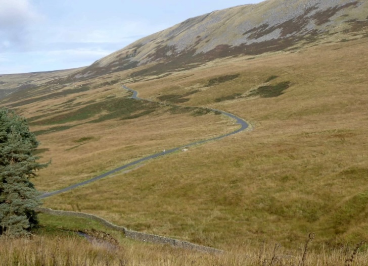
Today the spot is a local landmark and the apex of an increasingly popular hill climb for cyclists (the guy in this video must be fit as it is a hard climb!) motor-bikers and motorists enjoying the long winding road with its beautiful, panoramic views stretching in all directions.
A B-H

That road goes in forever on a cycle, coming from Slaidburn one looses hard fought height dropping down to Cross of Greet Bridge. Done it over to Bentham and Clapham and then back by Bowland Knotts and Gisburn Forest. I would need an electric bike nowadays!
Most plague stones are on the outskirts of villages, e.g. Brookhouse at Caton. Food could be left for the afflicted and their money placed in the vinegar. Cross of Greet sems too isolated for direct trade of that nature.
I favour the cross theory, but will we ever know.
LikeLiked by 1 person