In 19th century Britain much of the population found they had enough disposable income, and public transport links had improved enough, for tourism to take off in a really big way, this was largely due to the wealth that the industrial revolution created.
The industrial revolution, with all of the coal powered manufacturing activity associated with it, not to mention Milton’s “dark satanic mills”, had the unfortunate by-product of being very polluting. Therefore many thousands of these new tourists decided to escape from the dirt, smoke, and grime of the industrial interior of the country for the clear air and waters of the coastline.

I do like to be beside the seaside
In the Northwest of England the largest of these coastal resorts developed along the Fylde coast, with Blackpool as their undeniable capital, by 1909 the music hall composer John Glover-Kinde released the song I do like to be beside the seaside which became a number one hit due to the popularity of seaside holidaying.

A new supply of water
Around 1910 the town corporations of Blackpool, Fleetwood, Lytham and nearby towns realised that this seasonal influx of tens of thousands of people was causing the boreholes of the Fylde plains, which sit not very high above sea level, to run dry, leading to water shortages, and a possible threat to this burgeoning income of tourist money.
A committee was formed, the Fylde Water Board, and it was accepted by all parties concerned that only a decent sized reservoir could supply the quantities of water needed, after much surveying and consideration the site chosen was the upper Hodder valley, known as Dalehead, where the village of Stocks-in-Bowland was situated. This was largely due to the high rainfall in this part of the country.

Stocks in Bowland
The farming community of Stocks-in-Bowland was only a small hamlet consisting of scattered farms and cottages, there was a school, a hostelry called the New Inn, a village store, a blacksmith, and a small church; St James, but not much else.
In 1912 legislation was passed in Parliament to allow the construction of a reservoir at the site and the Fylde Water Board proceeded to buy all land in the area concerned, around 9,750 acres, through direct negotiation with the landowners, or by compulsory purchase, at an eventual cost to the FWB of £150,000, (that would hardly by you 10 acres now!).
The location of the dam for the reservoir proved quite hard to find as geologists surveying the area found there to be numerous small faults and uncertainties about the stability of the hills in either side of the valley. If it wasn’t for the discovery of a very small, but active, fault near Hamerton Hall the FWB would have had to buy that property as well but luckily the fault meant that the dam couldn’t be built here and it was instead sited a few hundred yards up the valley.
The ‘Great War’, or First World War, which begun in 1914 and lasted to 1918, halted construction work on the reservoir, but in 1919 work was resumed and procedures to move tenants from the land were started.
Many of the tenants who lived in the farms and cottages in and around the village of Stocks were not informed of the planned flooding of the village by their landlords or were simply illiterate and unable to read any notices that were put up. Luckily the rector of St Andrew’s in Slaidburn, the next village down the valley, had read a parliamentary report in The Times and thought to check that all the inhabitants of Stocks knew they were to be evicted.

Construction
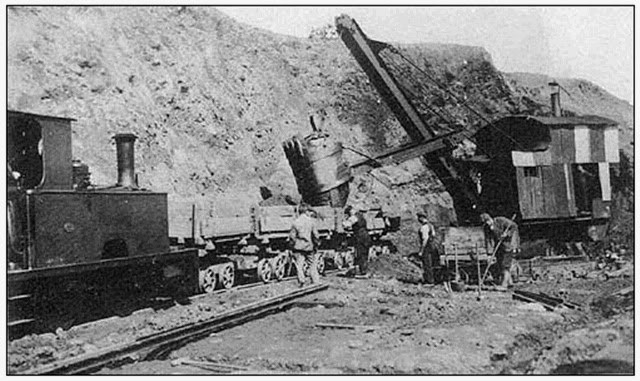
Construction of the dam began in 1921, continued for 11 years and involved the construction of a lot of preliminary infrastructure just to prepare the site.
The river Hodder had to be diverted through a specially built culvert, a temporary camp, the size of a large village itself and much bigger than Stocks, had to be built to house the mostly Irish navvies who would build the dam, and a network of railway lines, (of which I’ll write about in a future article), was constructed to transport stone to the dam from nearby quarries, including Jumbles quarry in the upper reaches of the Hodder valley where a Steam Crane still sits to this day quietly rusting away.
Although the dam for Stocks reservoir is by no means the largest it was still a monumental construction project, after the navvies had blasted and dug down to the bedrock they had to make the footings, or foundations, for the dam, which took the pouring of 11,876 cubic yards of concrete. Then 69,842 cubic yards of clay was used to make the centre of the dam, this was extracted from nearby fields as was 732,000 cubic yards of earth for the embankment of the dam.
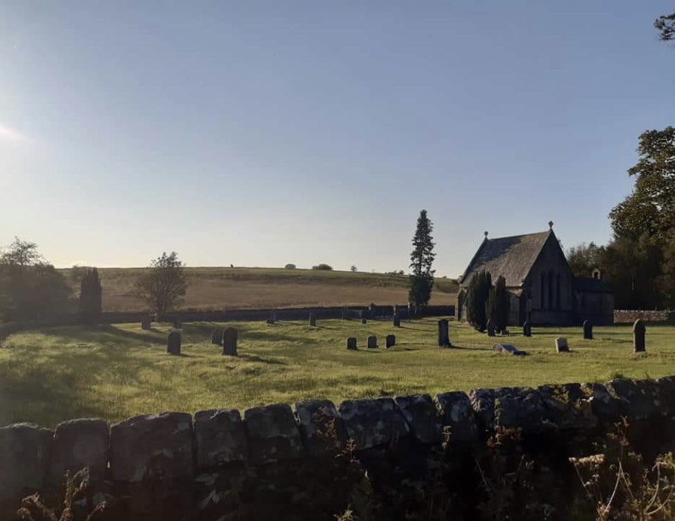
Moving St James Church
In 1927 the relocation of St James’s Church, otherwise known as Dalehead chapel, from the area due to be flooded to a new location on higher ground was started, first, 150 bodies were exhumed from the graveyard to be reburied in the new location.
In accordance with ancient tradition this was done at the ‘dead of night’, which is between midnight and 4 am, the volunteers for this task were ‘fortified with rum’ but the task was reported to have been ‘carried out with great decorum and respect for the dead’. Over 30 bodies from the graveyard could not be identified from parish records though so were interred in a mass grave.

The last service at Dalehead Chapel was held on May the 24th in 1936 and afterwards the whole building was carefully dismantled and rebuilt about half a mile away. The land that the chapel was rebuilt on was a corner of unimproved set-a-side land, which had never been fertilised or drained, so is now a haven for rare species of Orchids and other wildflowers.
Eventually, when the reservoir had been filled, it transpired that the location of Dalehead Chapel was above the highest level the water would reach and it needn’t have been demolished, you can see the foundations of where it stood at the main carpark for Stocks reservoir where an archaeological dig unearthed them in 2012, there is an information board there which explains more about the movement of the chapel.
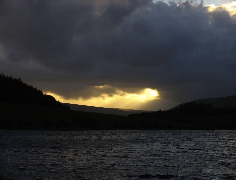
The reservoir today
The official opening of the reservoir, when the stopcock for the pipes that filled the reservoir was opened and a plaque was unveiled, was performed by Prince George on July the 5th in 1932 and since then the reservoir has become a firm destination for walkers, birdwatchers, fishermen and wildlife alike.
One of the islands in the middle of the reservoir has become home to a colony of Lesser Black Backed Gull, migrating Osprey often stop there to catch the Trout that the reservoir fishery stock the waters with and other species such as Greater Crested Grebe breed in the more secluded bays and inlets.
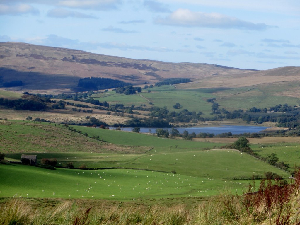
The reservoir is only a short walk from the nearby village of Slaidburn and there is a very popular circular walk all around the reservoir which gives you a sense of the overall scale of the reservoir and how beautiful the village of Stocks in Bowland, nestled in the Dalehead valley, must have looked before it was subsumed by the waters of the reservoir.

A B-H

6 thoughts on “The History behind Stocks reservoir”