
Great Pendle Hill and Penyghent,
and lofty Ingleborough,
Ye will not find three grander hills
and trace old England thorough
Nick O’ Pendle to the summit and back
This walk starts at the little car park on the apex of the Nick O’ Pendle road from Clitheroe to Sabden, just up from Pendle Ski Club and the Wellsprings restaurant.
It’s a very easy walk along well trodden paths, but these can be boggy in places and erosion from the many hiking boots which pass along this path has caused there to be pools of water in places after rain.
The walk should take about 3 hours and is around 6 miles in length, as always wear sturdy, waterproof boots with ankle support and carry a waterproof coat, bear in mind this is along the top of Pendle hill which is notorious for bad weather coming in unexpectedly, the map below is from Ordnance Survey map OL 41.
Please remember the countryside code too and as it’s sheep country, and many rare species of ground nesting birds are found up here, please keep your dogs on their leads!

Starting point
Starting at the car park (just a big lay-by really) in the old quarry at the top of the hill first cross the road to find a broad track that starts just below a memorial to servicemen who died in various plane crashes on Pendle Hill.

Pendleton moor to Ogden Clough
The next bit of the walk takes just under an hour and crosses Pendleton Moor then Spence Moor, then you dip down into Ogden Clough to join a path coming in from the right hand side.
Ogden Clough is a steep sided valley but fairly dry and easy going, eventually you’ll meet a lightly trodden path which goes to the left. As you climb a ruined wall will appear on the right, follow this as it crosses the ridge to meet a path above the top of Mearley Moor.

Scout Cairn
As you head right onto this path a large Cairn can be seen on the hill in front of you, this is ‘Scout Cairn’ and was placed there to commemorate Gordon ‘Peri’ Hampson, a former Clitheroe doctor and scout district commissioner who died in 1985.


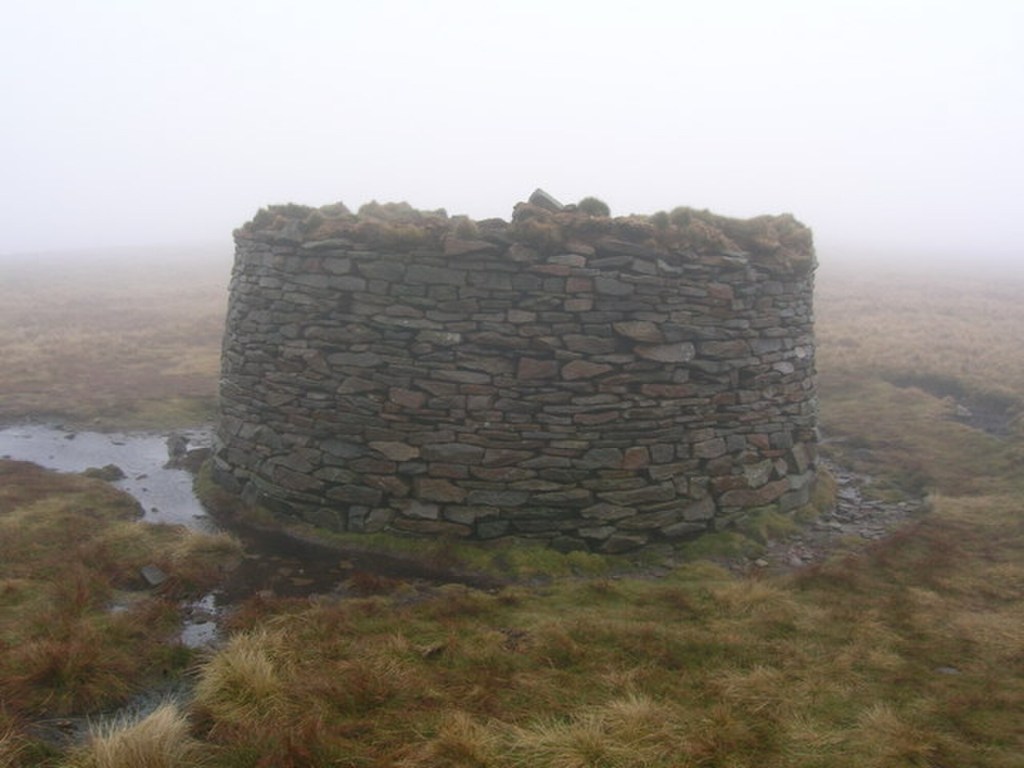
Towards the summit
After the cairn follow a wide path which takes you up to another Pendle landmark, a circular stone wind shelter.
It’s worth looking inside this at the little sculptures of fossils, such as trilobites, that have been placed in its walls, after you’ve passed this head straight ahead towards a drystone wall and cross over the ladder stile which you’ll find.
‘The first thing that attracted curiosity
and put our our scientific powers in play,
the first, too, that arrested the velocity
of our quick-moving footsteps by the way,
was Nature’s ample book, which open lay
within the fossil, rocks of Coplow Delf,
where shellfish, zoophyte, and the solid spray
of stony waves, stiff, piled up, shelf, on shelf, kooked like a sea turned marble by Medusa’s self.’
(Excerpts from ‘Pendle Hill’ by William Billington)
On the other side of the wall turn right and the track will bring you to a second ladder stile, which takes you over another drystone wall and up to a ridge which climbs gently upwards towards the summit of Pendle.
The path up to the summit is very easy to follow and on most days of the year there will be lots of other walkers who have come up from the village of Barley.

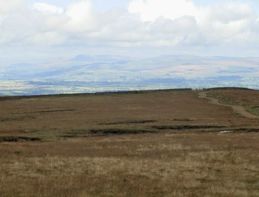
The views from the summit
The views from the summit of Pendle are some of the best in the north of England and as Pendle is fairly high, only 51 metres shy of being a mountain, and is far from any similar sized hills, there is almost a complete 360° panorama from the top, if it’s not completely shrouded in cloud that is!
Looking towards the north is the Ribble Valley with the Forest of Bowland behind it and to the north east you might be able to make out Ingleborough and Pen-y-ghent. To the South, looking over Black Moss reservoir, you may be able to make out Lad Law above Burnley and then, further round, Hambledon hill above Padiham.


Returning to the Nick O’ Pendle
Starting from the trig point (the white, rectangular obelisk looking thing) on the summit first turn South to find a flagstone path, this is soon joined by a stream that feeds into to Ogden Clough which will appear to your left.
This path leads to a wooden kissing gate and after that it crosses a stream, next is a path, follow this and take the fork to the right which will lead you to the path you walked up along, after this it’s only a pleasant walk downhill for a mile or so and you’re soon back at the Nick O’ Pendle where you started.
Let all, whose English hearts would homage pay
to Nature in her naked majesty,
repair to Pendle, and make no delay,
but, like the bard, proceed extempore, and prove his rustic rhyme, no strained hyperbole
A B-H
(Dec 2024)

Nice post🌅🌅
LikeLiked by 1 person
A classic walk can be varied for the return.
LikeLiked by 1 person