
I’ve poked and peered into all sorts of corners in my history articles, from Abbeystead to Whalley and everywhere between, but feel that I’ve overlooked some of the historical locations closer to home, around the towns of Padiham and Hapton where I live and work.
With this in mind I set out the other day to explore the hills above Hapton, (which I can see from our back window,) look at some of the ruins which litter the moors there and uncover the rich historical legacy they represent, which spans through the centuries from the Tudors to the Accrington pals.
Hapton’s Miltary History
The small town of Hapton sits halfway between the larger Lancashire towns of Accrington and Burnley and despite its modest size has played a significant role in the history of the United Kingdom, especially through our many wars and military campaigns.
Situated around the town are several relics of this military past, including the remains of two ‘Blacker Bombards’, static anti-tank weapons which were part of the Home Guard’s last line of defense in case of an invasion.
The former sites of two militarily vital industrial facilities are located here too; a chemical plant operated by William Blythe of Accrington, which produced Sulphuric acid, and the MEL (Magnesium Electron) factory.
The latter used seawater piped in from Southport to manufacture magnesium for rebuilding munition stocks after WWI (mostly for making fuses), and during WWII produced chaff, a radar countermeasure used by the RAF (and most airforces today) to confuse enemy radar systems.
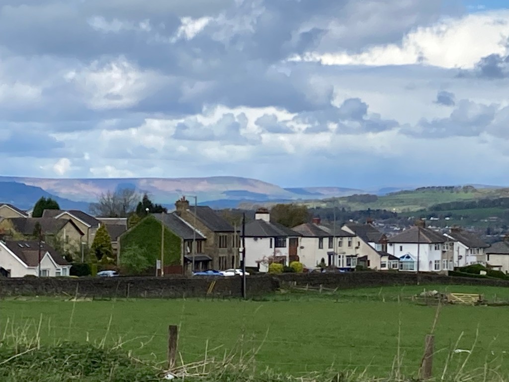
The William Blythe site is now a housing estate and the MEL factory has been replaced by a collection of vast warehouses. I’ve worked in one of them and can see it from my back window too, but very little sign of the site’s previous occupants remains, and you have to look very hard to find it.
I’ll write about those sites and others in the future but the the other day I decided to seek out one of the more obvious and accessible historical sites of which more has survived; Hambledon Firing Range.
Hambledon Range
As it turns out the history of Hambledon Range has already been covered in detail by the erudite and expert historian Richard Horrocks in A Brief History of Rifle Ranges on “Hambledon Hill”, so I’ve no need to repeat what has already been written. Instead this article will be more of an account of what I found whilst exploring it.
Hambledon Range is sometimes also referred to as ‘Hambleton’, ‘Hameldon’ or ‘Hapton’ Range(s). This is due to the fact that historical maps spell the name with either a ‘d’ or a ‘t’, do not show ‘Hambledon’ but instead feature ‘Hameldon Scouts’, ‘Hameldon Common’, ‘Little Hameldon’, ‘Great Hameldon’, and ‘Hameldon Hill’, and because in 1948, it was renamed ‘Hapton Rifle Range’ on maps.
Despite this confusion from overlapping place names and changes over time it is fairly easy to locate on the ground, so without need of a map or directions I set off the other day up the lane to the right of the Hapton Inn armed only with my new camera and optimism that the weather wouldn’t get any worse!
The hills above Hapton
The hills above Hapton are much scarred and mis-shaped by centuries of quarrying and mining, most recently of clay for firing the famous NORI Accrington bricks, and their topology provides a convenient back-stop for bullets.
With this in mind ranges were constructed there in 1860 for the use of the newly formed 17th Lancs (Burnley) & 84th Lancs (Padiham) Rifle Volunteer Corps (R.V.C.), here’s a brief timeline taken from Richard’s treatise on the subject;
Brief timeline of Hambledon Range
The volunteer forces were a citizen army of part-time rifle, artillery and engineer corps, created in 1859. Practice ranges, like Hambledon, were constructed around the country for their use during 1859 and 1860.
- 1862, 1000 yard range opens for use of R.V.Cs to practice with Pattern Enfield 1853 rifles of 0.557 in. calibre.
- In 1865 “Capt. Hill’s Disc Marking Mantlets” were installed.
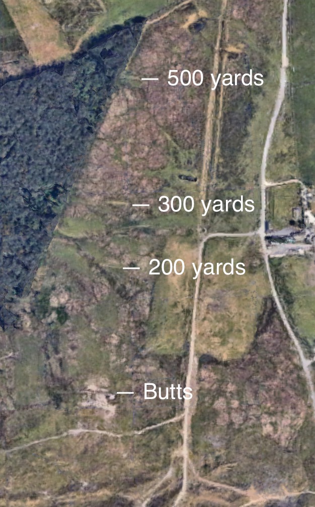
- 1895, new firing points installed at 500, 300 and 200 yards.
- 1899, the range’s targets were converted from a solid iron type to penetrable.
- 1912, Range modified for 6 targets.
- 1921, Range fully converted to a Gallery Range with 12 targets.
- Post WW2, range reduced to the 500yd range you see now.
- 1969, Range closed.


Reaching the Range
Today the site of the 500yd range, with its 500, 300 and 200yd firing points, and target butts, is easily accessible, I got there by walking up Hambledon rd, a narrow country lane which joins Accrington road at the corner of the Hapton Inn.
The road up is really just a narrow country lane with a mild gradient and little traffic, normally you will have a pleasant view back over the valley towards Pendle but on this day it was grey and drizzly (normal for this part of the world!).
At the top of the lane there is a cattle grid and then a public footpath to the right, if you follow this for a couple of hundred yards you get to a forestry plantation, if you turn left before entering this and follow the fence-line you soon encounter the 500 yard firing points.

The 500 yard firing points
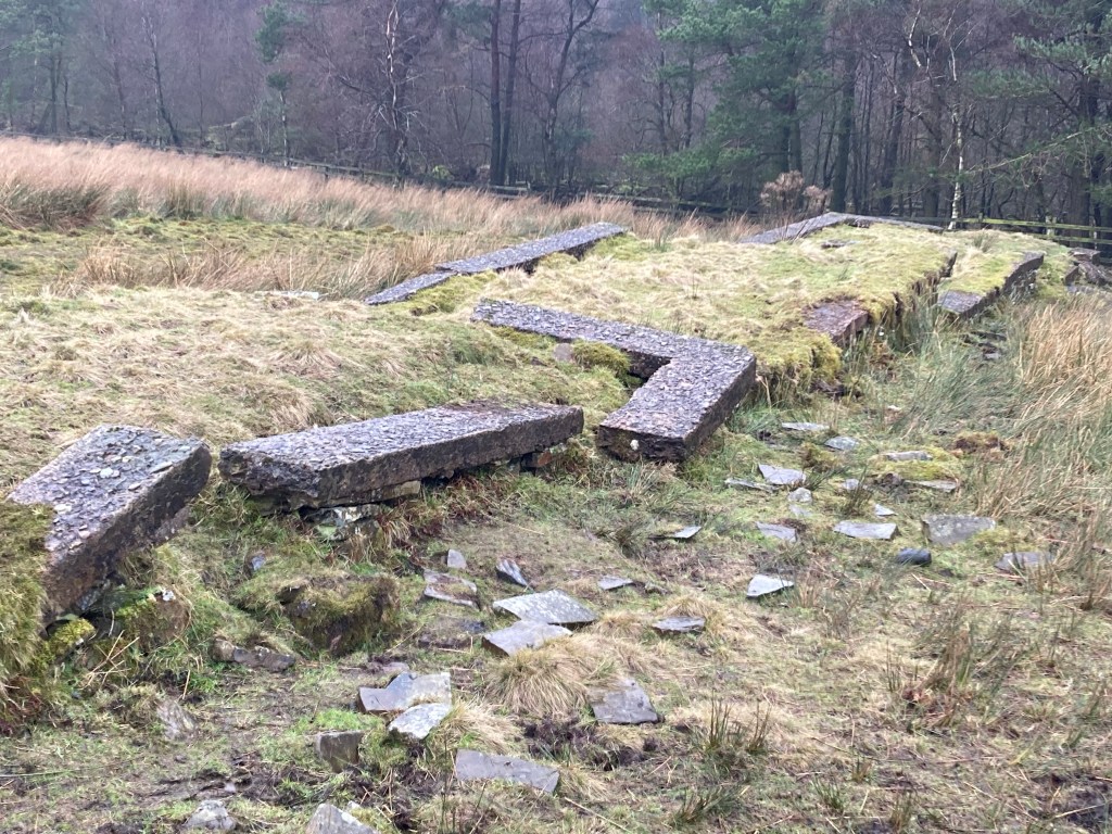
All that remains of the 500 yard firing points today are their stepped foundations outlined in 4 concrete rectangles.
Standing there and looking uphill towards the butts through the drizzle I thought to myself that the hill behind provided such a great backstop that it would be very unlikely for any stray shots to pass over its 1700ft summit.
However according to Richard’s history some shots did indeed pass over the hill as bullets were found by the side of Rawtenstall road 3km away, this led to the use of machine-guns being banned at the range in 1953.
Having some experience of shooting on ranges myself I doubt that any shot could have been that bad and they must have been ricochets instead.
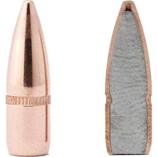
Indeed when jacketed bullets (see diagram below) came into use around 1895 the original solid iron targets had to be hurriedly replaced with penetrable targets so that the bullets would pass through and bury themselves harmlessly into the ground, as ricochets can literally travel for miles and still injure or kill someone.
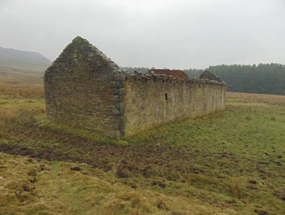
The Range Houses
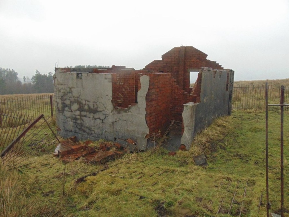
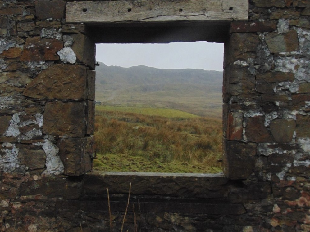
About halfway up the hill between the 500yd firing points and the butts are a couple of ruined buidings, one is a roofless stone barn, the other is the brick shell of what was obviously a toilet block.
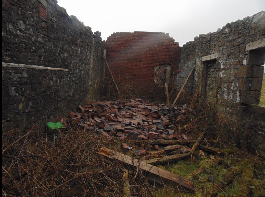
The barn is known as the ‘range-house’, but is empty of any sign of its use during the firing range’s lifespan, its structure is deteriorating rapidly and recent storms seem to blown down one of its interior brick walls. I didn’t fancy risking exploring it any further, so after taking a couple of what I reckoned to be ‘arty’ shots with my new camera through its glassless windows, I left to poke about the ruins next to it.
This building is surrounded by a half-collapsed iron fence and shows all the hallmarks of an austere military construction, it was obviously a toilet block judging by the remains of fixtures and plumbing, it’s also collapsing but less dangerous than the stone barn.

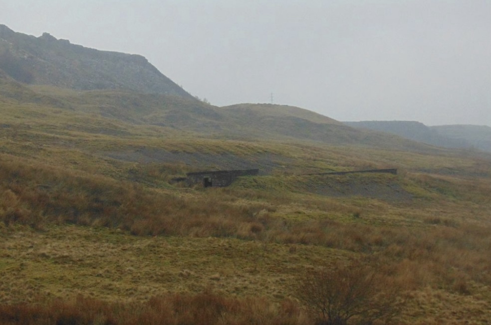
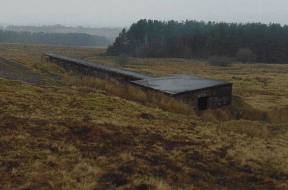
The Butts
I didn’t try to find the 300 or 200yd firing points, the area is extremely boggy and I’d already noticed an uncovered manhole hiding in the rushes so it didn’t seem worth it, maybe another day?
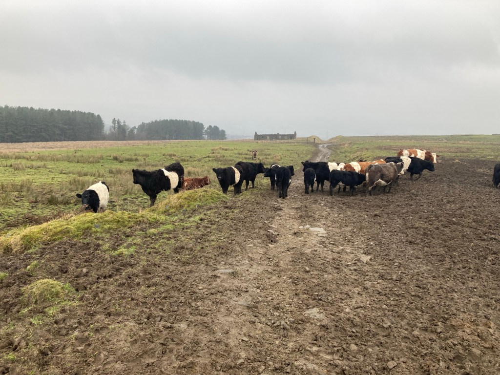
So I walked up the muddy track instead, through a herd of calm Galloway cattle, uninterested in me as they were occupied with a bucket of treacle and a newly-filled feeder, to look at the target butts.
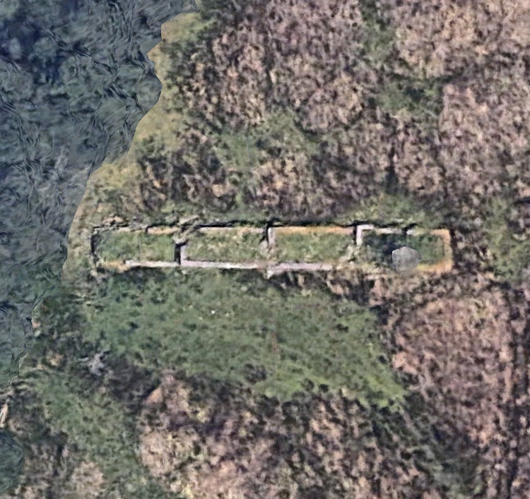
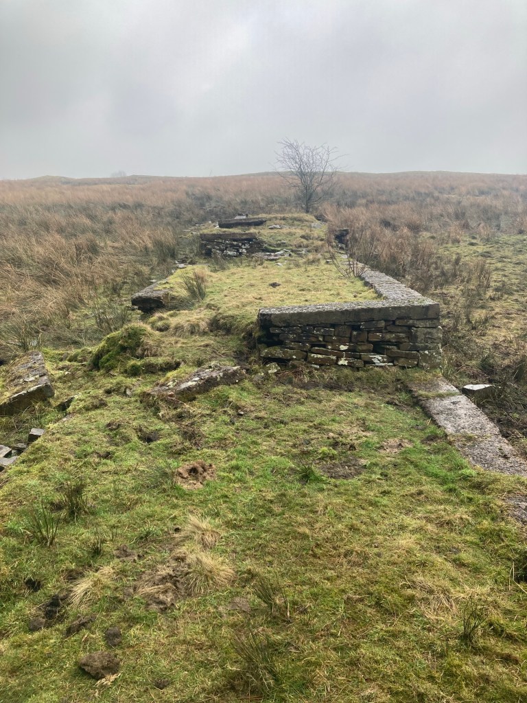
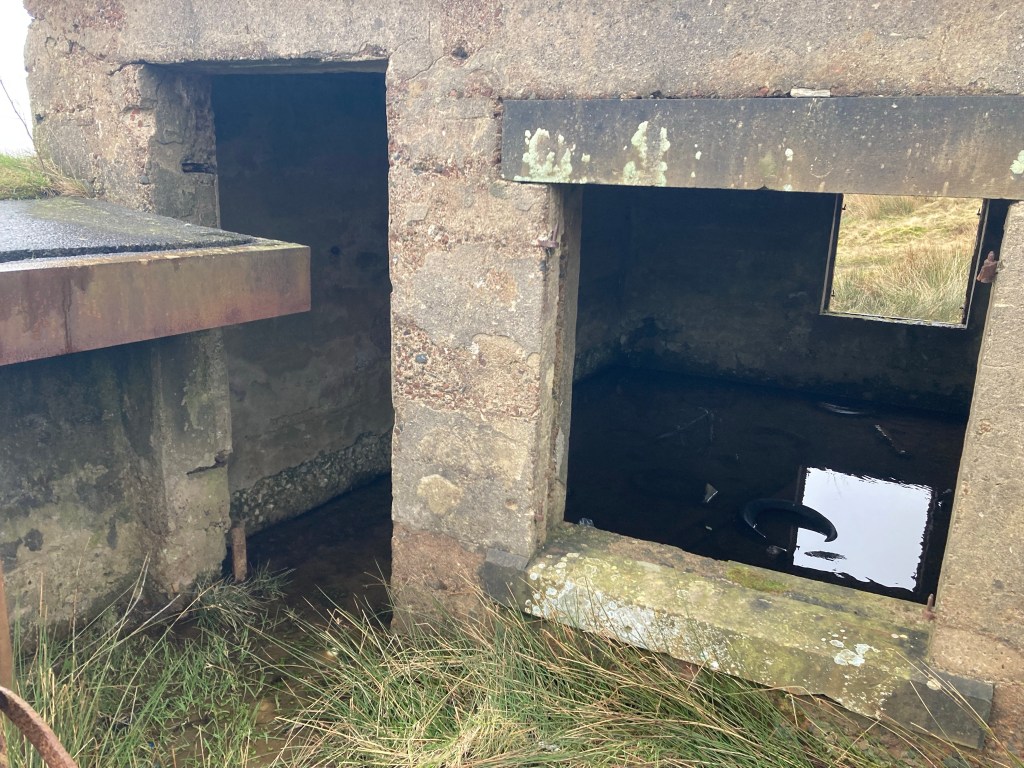
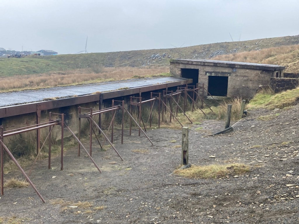
The butts are situated where the contours tighten at the base of the hill, and are composed of a small, partly flooded brick hut and a long, half-buried concrete structure with a set of rusty iron frames backed by a bank of shale.
The frames held the targets which would have been winched up and down after each session to gauge the accuracy of the shots, I couldn’t figure out how they would have worked but the operator would presumably have sat safely in the hut whilst target shooting was occurring.
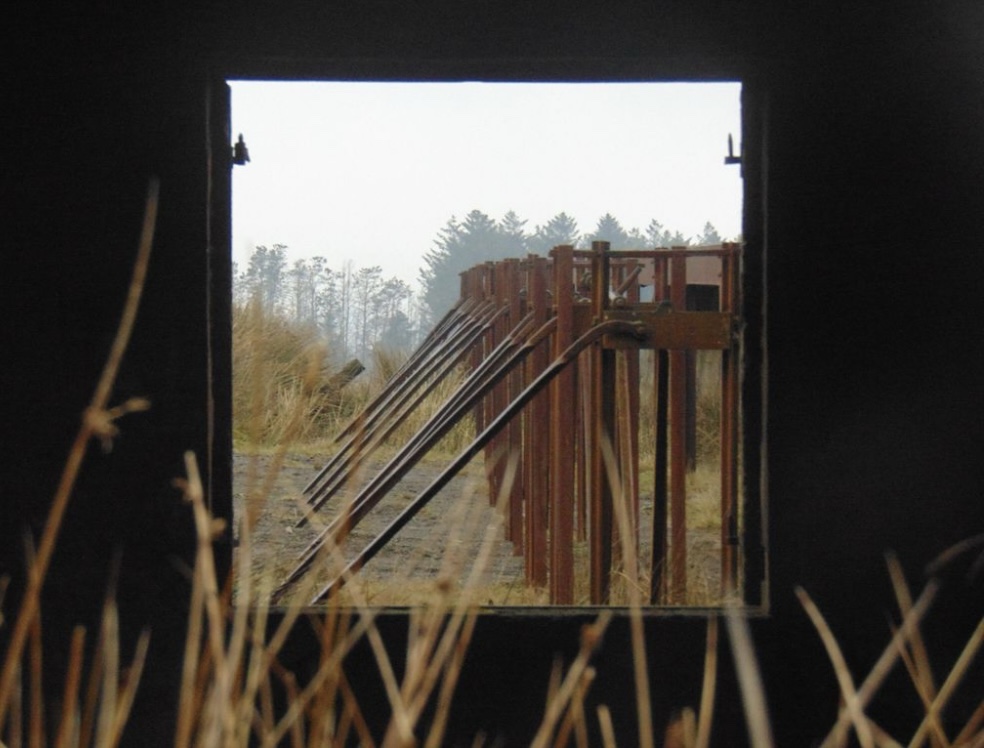
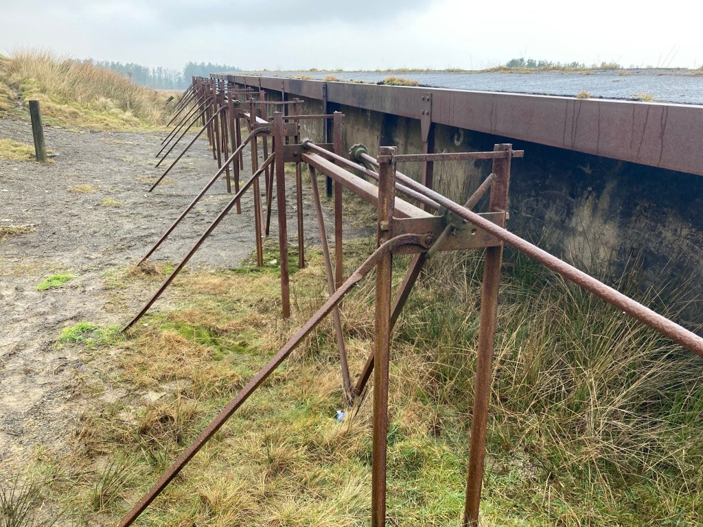
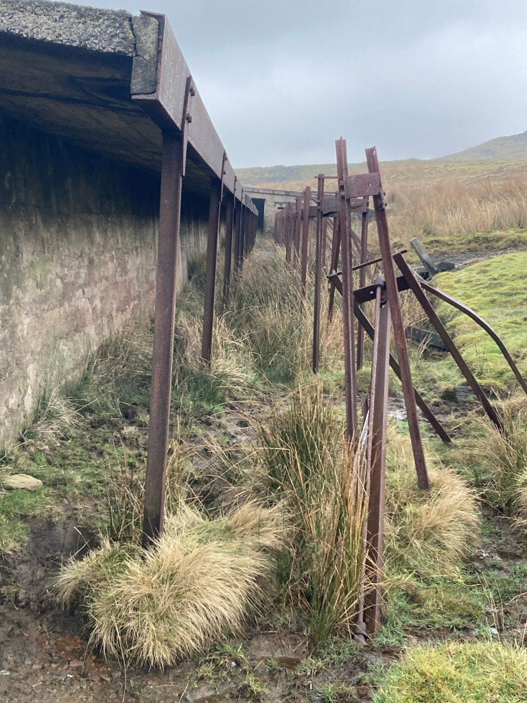
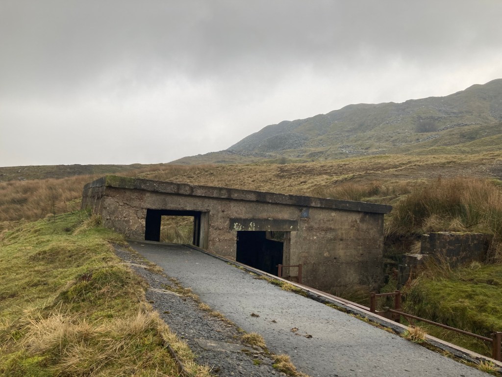
Behind the frames was a bank of shaley gravel which would have safely caught the bullets, it is marked with a regular pattern of furrows which, I can only guess, show where it was topped up from above.
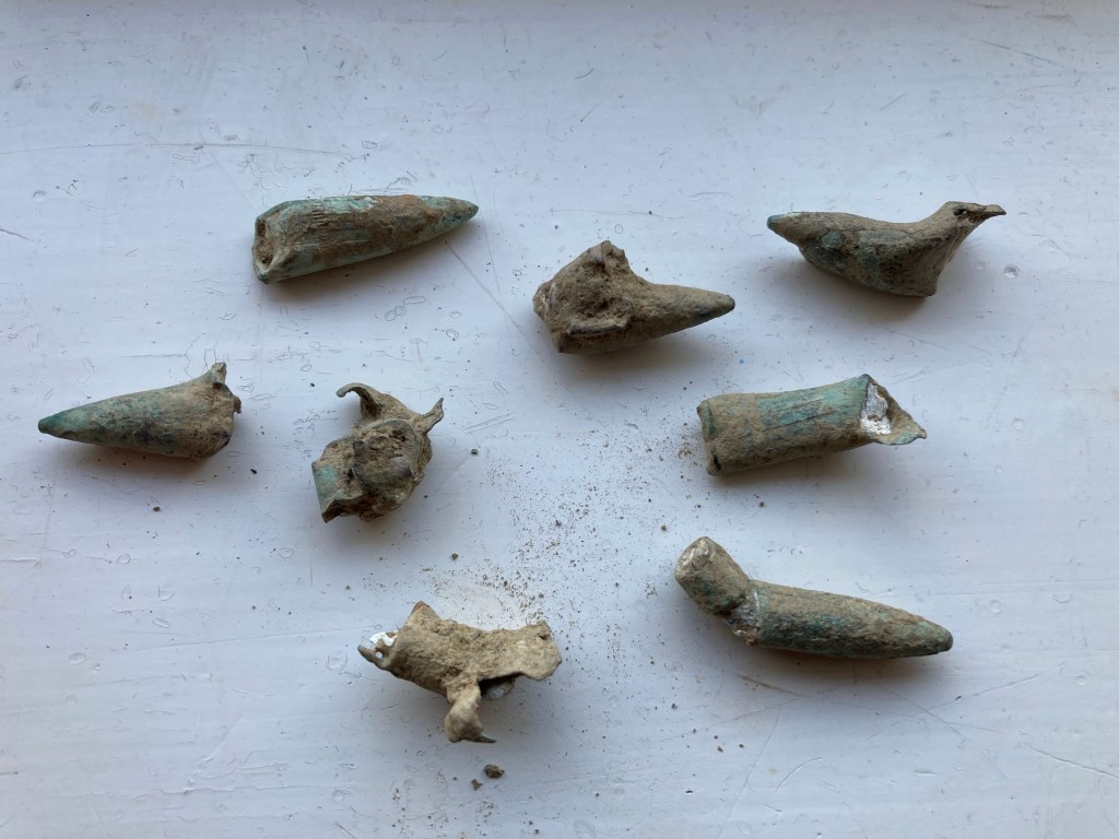
Rootling about in the gravel I found several spent bullets, they all seemed to be the ‘pointy’ .303 Mk VII type, they’re not the best examples but I imagine if I went up here with my neighbour and his metal-detector we could find some better ones.
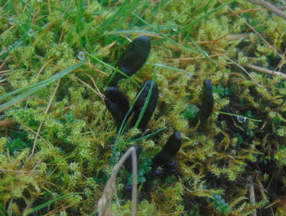
I also found a colony of rare Earth-tongue fungi, which I’ll return to identify properly, this surprised me a little as you would presume the large quantities of lead present might have poisoned the ground.

The ruins of the target butts are in amazingly good condition, so well worth visiting for any military historians, the wider area is historically interesting as well, with many sites close together in a relatively small area.
Next to the ranges are extensive earthworks which show where a tramway once ran down from the clay quarries to the brickworks where Accrington brick was once fired, and somewhere up on the tops is a WW2 bunker.
I’ve also read about a fascinating ‘Starfish’ site on the moors further up, starfish being the codename for a network of fake towns, bases and airfields constructed throughout the nation during WW2 to deceive German bombers and prevent them attacking genuine targets.
These and the sites mentioned earlier are all things I intend to explore, learn more of and write about here in the future.
A B-H
Feb 2025

Have walked through there on The Burnley Way without realising the significance. Thanks.
LikeLiked by 1 person
I never realised how much history is up there, there are prehistoric ruins somewhere too
LikeLiked by 1 person