This is a short 3 mile walk around Beacon Fell Country Park, it should take about a couple of hours, including time to have a picnic!
The going is fairly easy as a large proportion of the route is on country lanes or paved, and the descent and return back to the carpark are on a gentle slope so is not too strenuous in that respect, all the same please make sure to wear a decent pair of walking boots and bring a suitable coat for the weather.
It’s also well worth taking a picnic to enjoy at Brock Bottom as many people have traditionally done over the years.
Below is the route as marked out in purple on Ordnance Survey map OL41, (please ignore the red marking that’s a different route I might post in the future)

Start at Beacon Fell Country Park carpark
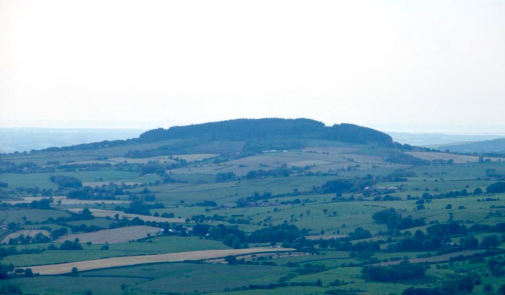
Starting at the car park at Beacon Fell Country Park first follow the path downhill to the southwest through a new plantation of trees. Before you set off make sure to admire the view over the Fylde plains between the tree-tops, this will also give you a clue as to what the weather might be like for the rest of the walk as you look into the prevailing wind.
Next you will reach an older patch woodland, in spring this is full of native Bluebells and in autumn many different types of funghi can be found here, the last time I walked through here there was quite a few Shaggy Inkcap on the edge of the trees. Here is a rather attractive house called Salisbury House and its driveway takes you down to a country lane called Bleasdale road.

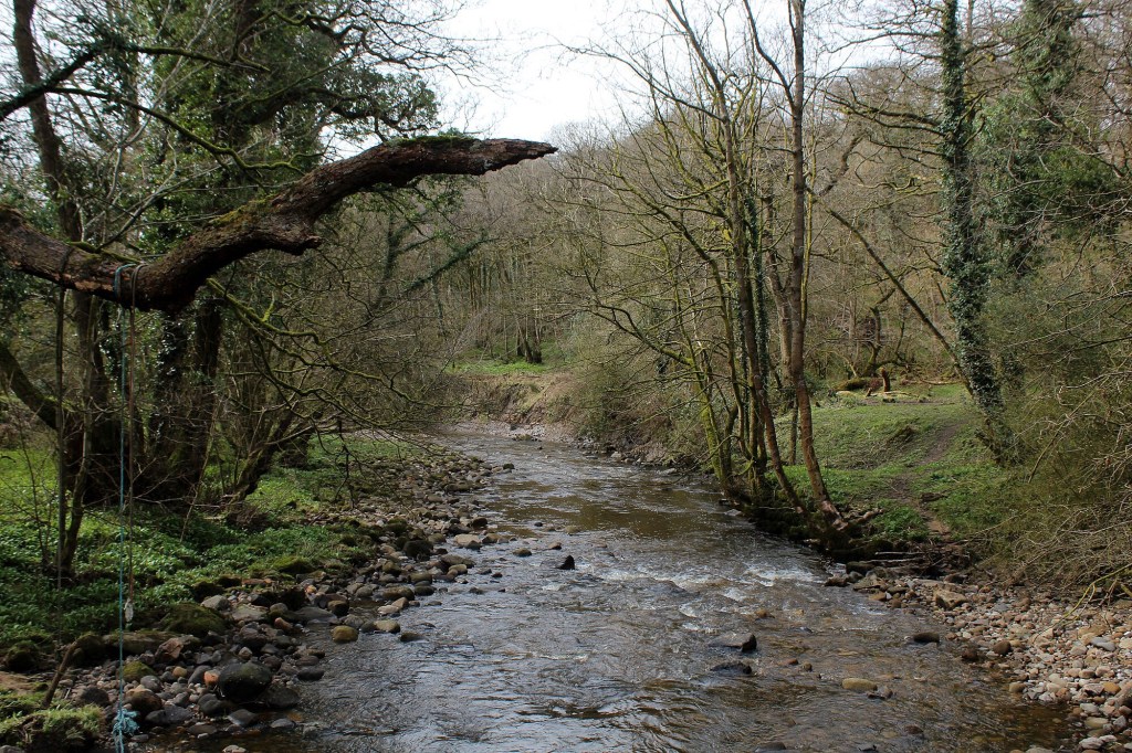
Brock Bottom
At the end of Bleasdale road turn right past a white painted 17th century farmhouse called Stannalee Cottage and then down Stannalee Lane to a house called Rake Head.
Here take the path to the right that leads downhill, this passes through more woodland and takes you to the locally well-known picnic spot of Brock Bottom, here there is a footbridge which is good for playing Pooh sticks from or otherwise admiring the scenery, if you are here for long enough you might even see a Dipper whirring its way along the river or fishing along the riverbed.
The path runs alongside the river for a short while, giving you plenty more chances to spot riverine wildlife before eventually reaching Higher Brock Bridge over which White Lee Lane crosses.
Follow this lane uphill (the purple line I’ve scribbled on the map) back towards Beacon Fell, the lane will reach a T junction eventually but if you look to your right you can see the sign for the footpath up, this crosses over a field and then into Mary Bullivant Memorial garden, which is a life for a life tree plantation.
Returning to the carpark
Here you can turn right to head back to the carpark or carry on up to the summit of Beacon Fell, this isn’t very far or steep and well worth the panoramic views all around the surrounding countryside and over the Fylde plains towards the distant Irish Sea, these views help you understand why beacons were placed upon here in ancient times to warn against invasions.
A B-H
(Sep 2024)

Lovely. What’s the public transport like to get here?
LikeLiked by 1 person
Hi Mark, it’s not brilliant to be honest but you can get a bus from Preston to Goosnargh, i think there’s extra buses in the summer holidays too https://www.prestonbus.co.uk/bus-services/46/
LikeLike